
Introduction to Subsurface Engineering and Locating
by Julia Ribeiro (Coffey Communications) and Marc Hungerford (Coffey Director of Field Services and Chief of Parties)
In the beginning of the 1980’s, collecting data on pre-existing utilities was not a common practice amongst project managers. This lead to construction delays and unexpected expenses that could have been avoided with the use of Subsurface Utility Engineering (SUE). Today, nearly every state has SUE embedded as a routine in all projects. Continue reading to understand why the demand for SUE has dramatically increased over the past three decades and how your firm can benefit from the practice.
What is SUE?
Let’s begin with a brief introduction to the acronym that has gained worldwide popularity these past few years, SUE:
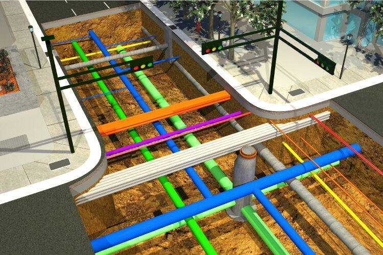
Underground utilities illustration. Source: csengineermag.com
Subsurface utility engineering, also known as SUE, is a branch of civil engineering that focuses on locating and collecting data on underground utilities. The practice of SUE is crucial to any construction or remodeling site as it prevents the encounter of unknown utilities in the ground, reducing the occurrence of costly relocations, project delays and avoidable accidents.
What is the difference between SUE and SUL?
Both SUE and Subsurface Utility Locating (SUL) locate and map utilities; the main difference between the two methods is the nature of the investigation.
SUL, also known as private locating or one-call, has damage prevention and public safety as its biggest concern, therefore is most valuable in an active construction site. SUL focuses on marking utility locations on site, for workers and the public to be aware of potential danger. Common practice for marking locations include: color-coded paint, flags, site photographs and field sketches.
SUE, on the other hand, is most useful in the design phase of construction projects. SUE classifies quality levels of pre existing data and also locates hidden underground utilities, and then transforms the data collected into a utility map. SUE will also relocate utilities and develop a new design for utility layout.
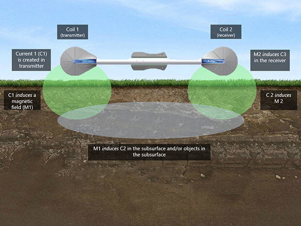
Electromagnetic induction tool utilized in both SUE and SUL. This tool is ideal for capturing non-conductive utilities and should be paired with GPR to clarify inaccurate information. Source: www.geophysical.com

Vacuum excavation is a non-destructive digging instrument used in SUE. The method combines compressed air, air suction, and water jets that expose buried utilities without damaging them. Opposed to traditional methods of digging that may destroy utilities. Source: vac2u.com
Application of SUE in Engineering and Surveying
The localization of utilities is a challenge construction projects always encounter, especially when remodeling in an already developed region, since many site plans contain outdated and inaccurate information of where installations lie. At Coffey, our engineers utilize the finest technologies to deliver reliable information. Our services include:
Topographic and Utility Surveys
Subsurface Utility Mapping and Design
Ground Penetrating Radar (GPR)
Benefits of SUE
Reduces utility relocation
Reduces project delays due to unknown utilities
Reduces surprise encounters
Reduces costs associated with utility relocation and delays
Levels of SUE
Quality levels of subsurface utility engineering are divided into four categories and represent different levels of data collection:
Quality Level D: information relies on already existing utility records and verbally forwarded information. In this level, an overall feel for congestion of utilities is provided but accuracy on information is doubtful.
Quality Level C: combines information from Level D with above ground utility surveys. In this level it is common to see information from levels D and C contradicting each other, since some underground utilities are omitted or incorrectly displayed.
Quality Level B: determines the existence and horizontal positions of utilities through appropriate geophysical methods and is known as “designating”. The information is surveyed to present control.
Quality Level A: also known as “locating” (SUL), is the highest level of accuracy available and utilizes subsurface utility engineering to the fullest. It provides precise information needed to plan and map underground utilities in a non-destructive manner. Quality level A is recommended for complex projects that demand more accuracy and less risk.
Benefits of Subsurface Engineering with Coffey
Information is key to every great decision, that is why collecting accurate data is always the first step of any successful plan. Coffey combines utility mapping with traditional record research and innovative surface geophysical technology in order to deliver results.
Featured below are past Coffey projects that utilized SUE as a foundation for the renovation and construction of buildings.
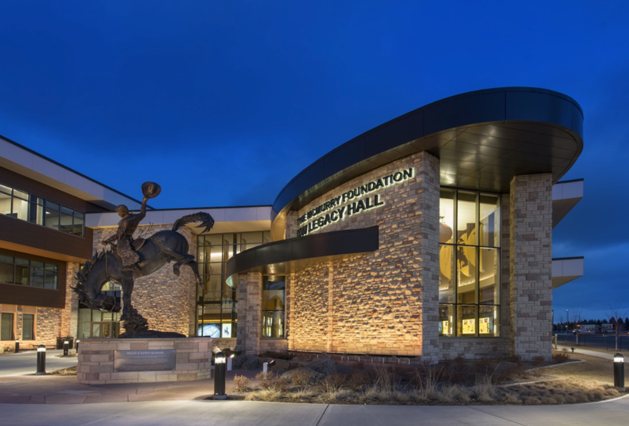
University of Wyoming Gateway Center
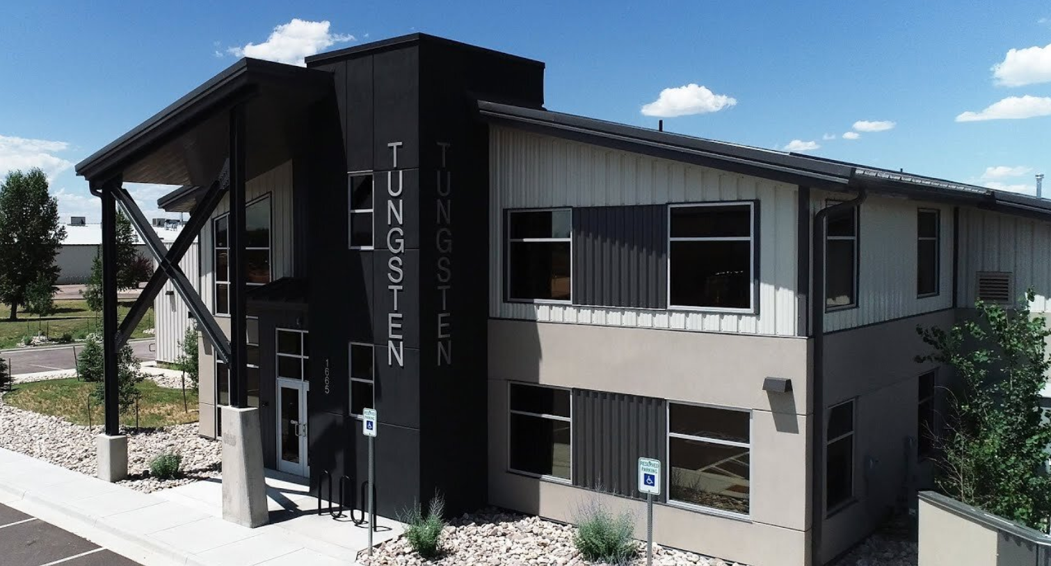
Tungsten Heavy Powder and Parts Building
Thank you for reading our article written by Coffey Engineering & Surveying communications specialist Julia Ribeiro and Director of Field Services and Chief of Parties Marc Hungerford. If you are interested in the application of subsurface utility engineering for your project or have an inquiry about other civil engineering and land surveying services, we invite you to contact us by email or phone.