

The Role of Floodplain Management in Public Safety
by Marisa Marulli (Coffey Communications)
and Ramsey Pickard, PE (Coffey Project Manager)
In the wake of the 2013 floods that occurred in the Southwest region of the US, new floodplain maps for the front range area are being created by the state of Colorado and the Federal Emergency Management Agency.
Floodplain maps started as records that were updated sometimes as infrequently as every 30 years, but fortunately with the advancement of technology it is now possible to update mapping daily or as changes are needed.
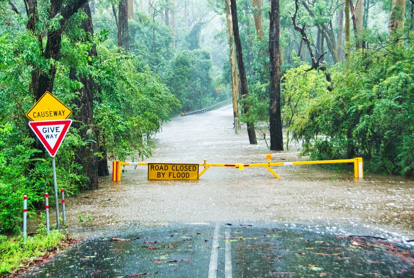
Street closed due to flood hazard. Source: Unsplash.com
What is Floodplain Management?
Floodplain Management (FPM) is an effort made by a community to prevent and respond to floods. The goal of this process is to protect citizens from physical danger and economic loss that would occur from flood hazards.
Floodplain management became a more widely recognized concept in 1968, when the Federal Emergency Management Agency (FEMA) developed the National Flood Insurance Program, incentivizing communities to enforce floodplain management ordinances (no build zones, waste plans, etc) in exchange for economical, federally-backed flood insurance policies.
Essentially, the 20,600+ communities that participate in the NFIP today get better insurance rates, because the preventive measures they abide by help mitigate the risk of flood hazards.
It is important to note that the NFIP was established at a time when flood insurance rates were so high that policies were less attainable. In fact, high rates were a big motivator behind the program.
Everyday Applications of Floodplain Management
FPM and FPM services may likely cross your path at some point. You may need to be aware of the flood zone your home is in and/or if your community participates in the NFIP.
Other instances you may come across floodplain management are if you are:
Buying or selling a home that is located in a classified flood zone
Building a property on land that is in classified flood zone
Modifying a property that is in a classified flood zone
Searching for insurance rates for properties that are qualified for a re-mapping
A Closer Look at a Floodplain
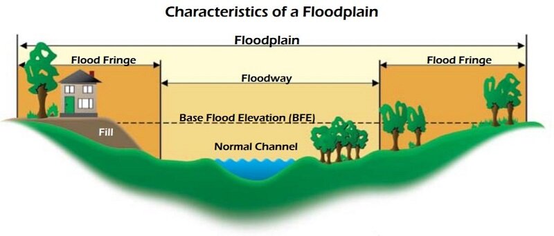
A visual representation that shows where floodways and flood fringes are located in the environment. Source: Wisconsin.gov
Whether you are buying a home or ready to meet with a floodplain specialist, it may be beneficial for you to get a preliminary sense of what a floodplain looks like and its various parts.
A floodplain consists of two main parts:
a floodway
a flood fringe
The floodway is the main channel for water streams (such as rivers). Properties cannot be built on a floodway, and adjacent land must maintain a free passage so floodwater is less likely to accumulate.
The flood fringe is the remaining, outer region of the floodplain. Not located in the main channel, the fringe is an area where building property is permitted so long as it does not create subsequent hazards for other community members.
In order to prove such negative consequences would not happen from a project build, an engineering study with hydraulic modeling, flood elevation and/or floodproofing is required.
The Application of Floodplain Management
A consultation with a floodplain management specialist can be beneficial for NFIP community members when they are:
Buying or selling a home that is located on a classified flood zone
Building a property on land that is classified flood zone
Searching for insurance rates for properties that are qualified for a re-mapping
Benefits of FPM with Coffey
Coffey Engineering & Surveying assists clients in various areas of floodplain management, such as the process of attaining a floodplain certification (also known as an elevation certificate) in order to build on a floodplain. We also help clients remap flood zones, which can be necessary when a client feels their area has been mismapped. Remap adjustments can result in permission to build where previously not allowed, or even in qualification for lower NFIP rates.
Where to Begin?
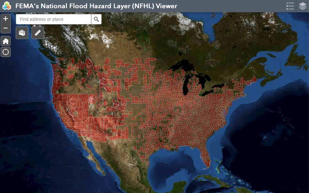
FEMA’s national interactive flood hazard map. The current effective flood data is displayed here, where maps are modernized as studies go effective. It is a compilation of Flood Insurance Rate Map and Letters of Map Revision. Source: https://hazards-fema.maps.arcgis.com
If, after reviewing this article, you feel inclined to learn more about floodplain management and want to take an initial look at a property of interest’s flood situation, you may utilize the FEMA NFHL Viewer provided in this article to determine what flood zone your property lies in.
If you have further questions and would like to contact a floodplain specialist, please do not hesitate to contact Coffey Engineering and Surveying.
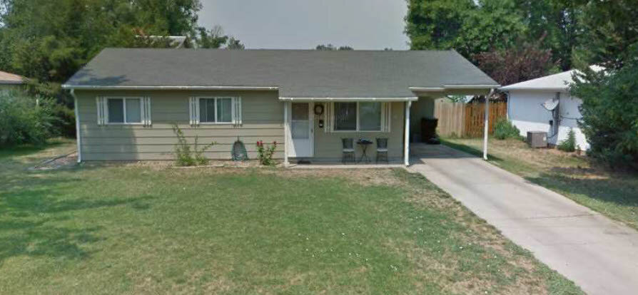
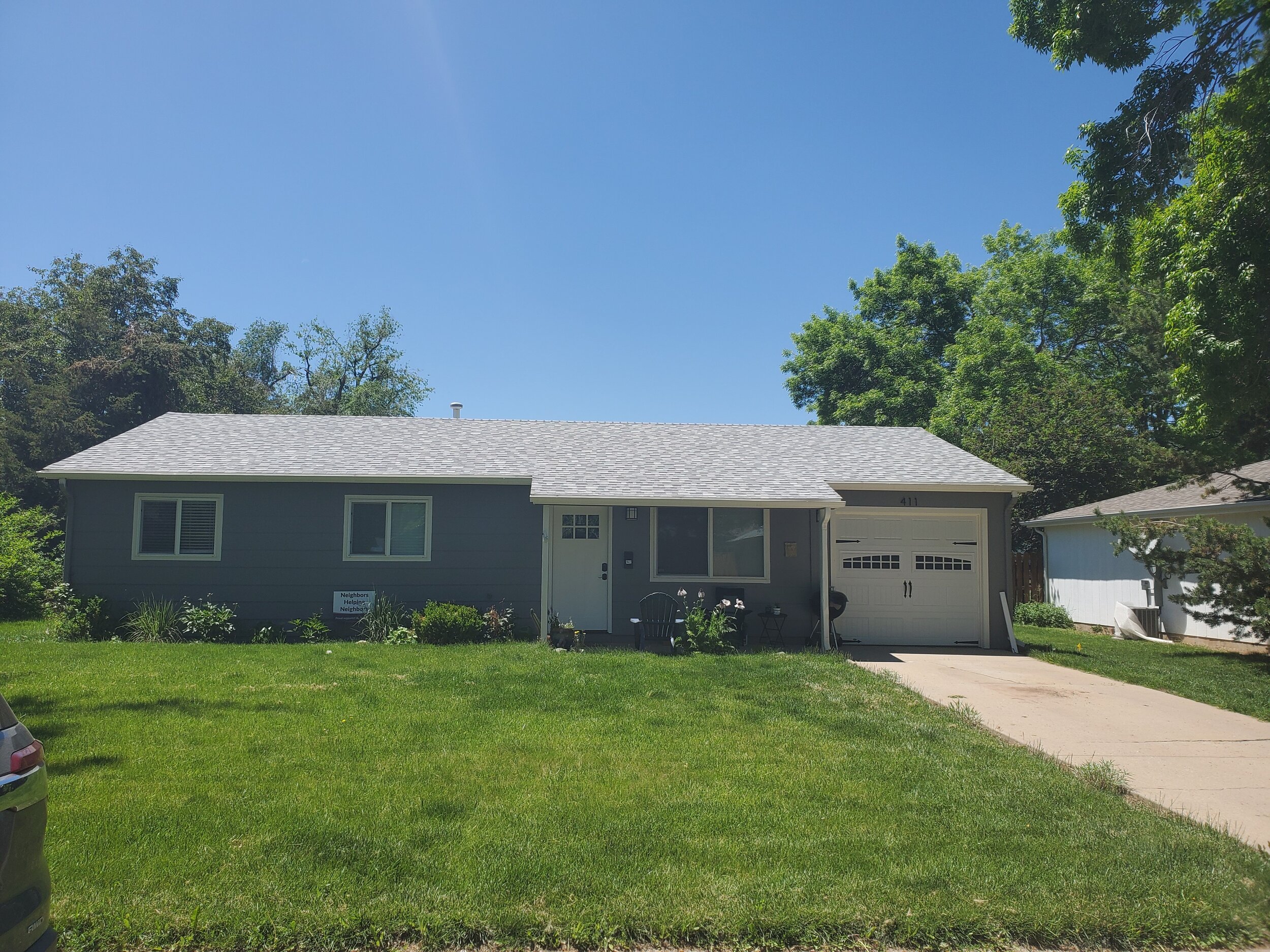
Past Floodplain Project done by Coffey
Featured below are the before and after pictures of a floodplain project Coffey Project Manager, Ramsey Pickard, performed at 411 Franklin Street in Fort Collins.
This client approached Coffey because they wanted to transform their open carport into a closed garage. Since the house was located in the West Vine Basin 100-year floodway, a floodplain analysis needed to be performed in order to prove that improvements did not raise Base Flood Elevation, cause the floodplain to increase nor endanger adjacent properties.
Ramsey used conveyance shadow identification to prove that enclosing the carport would have no adverse impact to the floodplain.
Thank you for reading our article written by Coffey Engineering & Surveying Communications Specialists Julia Ribeiro and Marisa Marulli, and Project Manager Ramsey Pickard, PE. If you are interested in the application of floodplain management for your project or have an inquiry about other civil engineering and land surveying services, we invite you to contact us by email or phone.