

Technological Advancements in Land Surveying
by Julia Ribeiro (Coffey Communications) and Chase Corbridge, PLS (Coffey Senior Project Manager)
Land surveying has experienced a revolutionary advancement in technology, especially when one considers that this ancient practice dates back to 1400 B.C., when the Egyptians began taxing land plots. Since, land surveying has evolved from the compass and chain method to unmanned aircraft systems. It is undebatable that technology has provided precise measurements in places our ancestors would never have imagined, such as the surface of the moon.

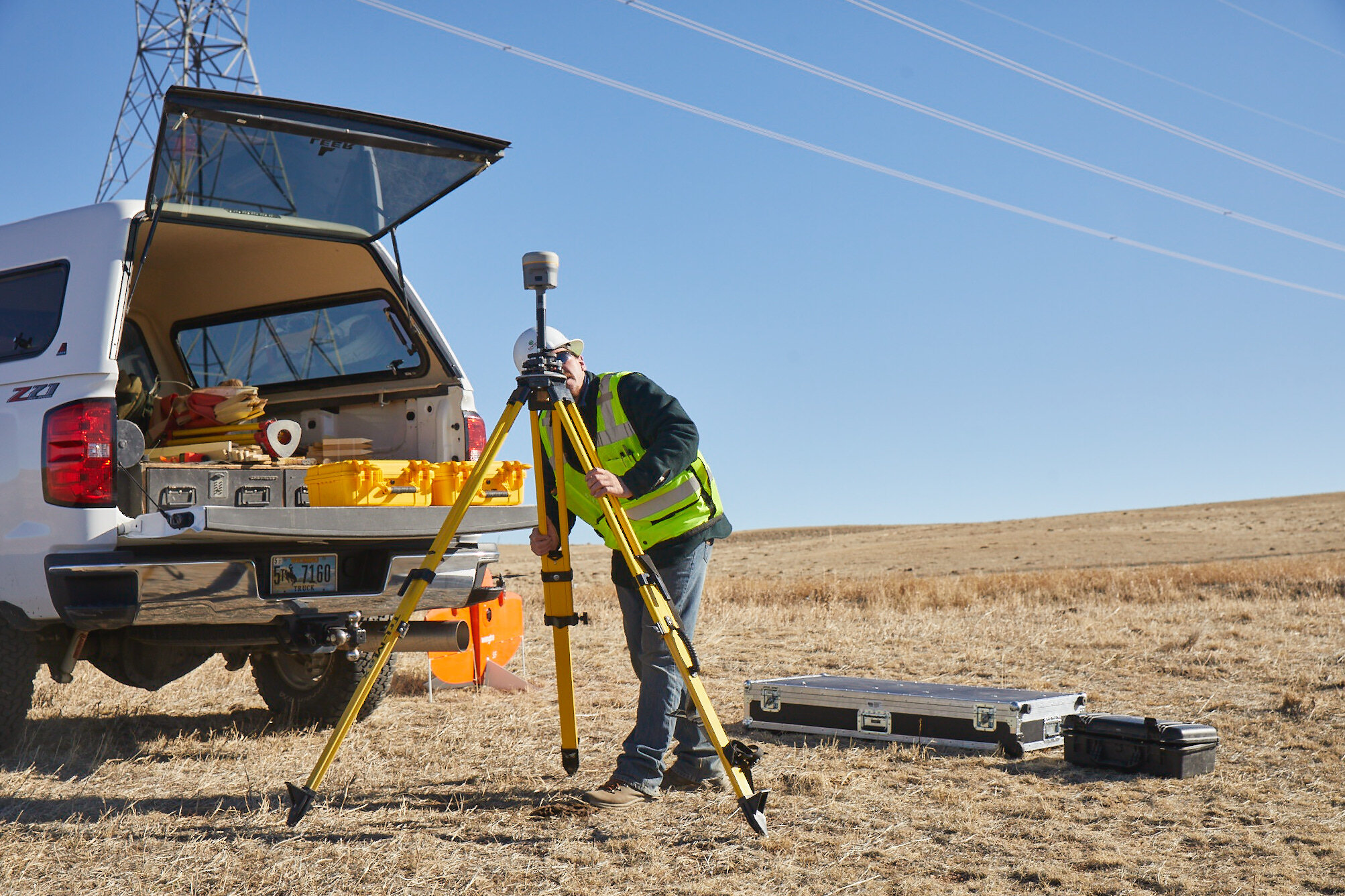
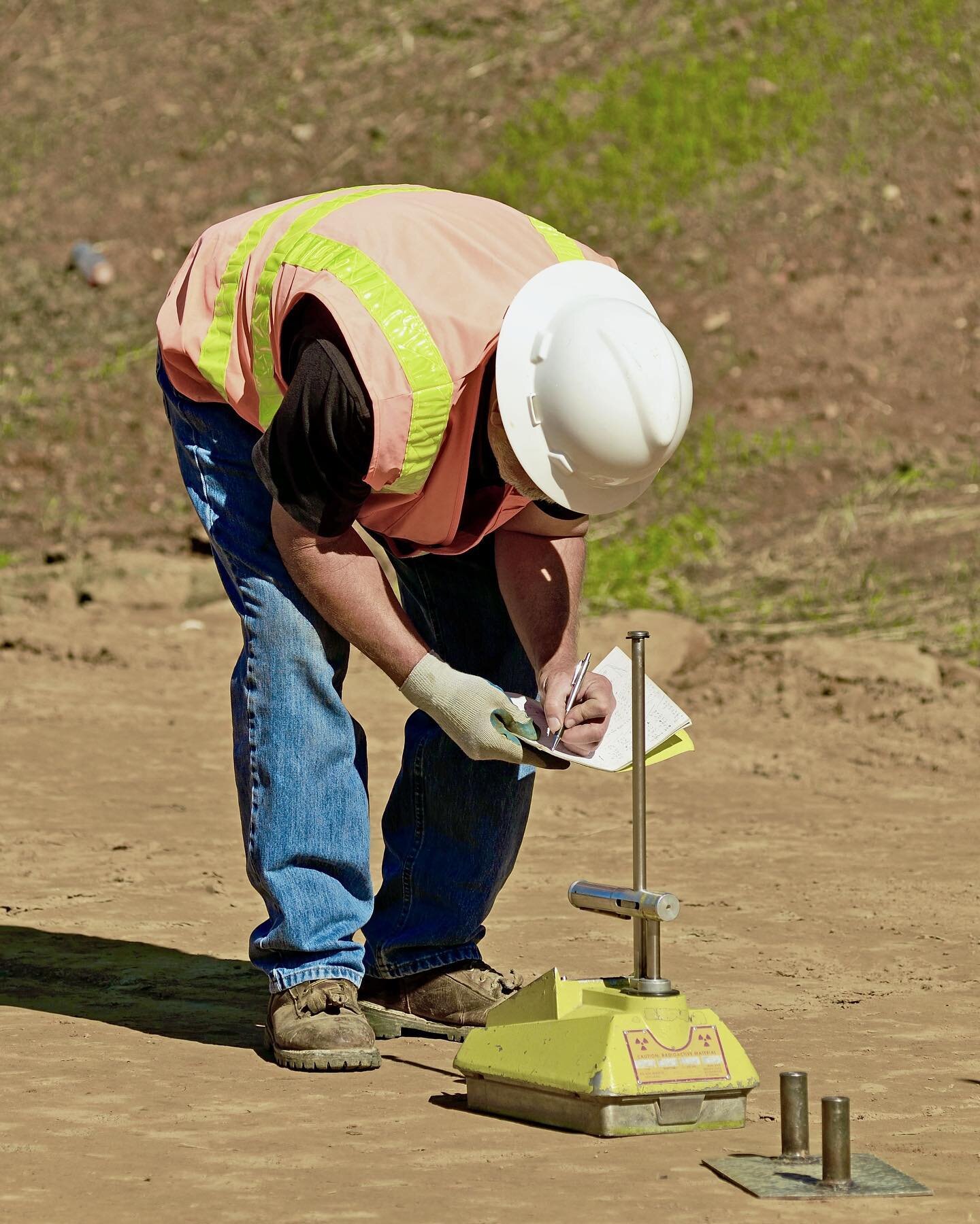
Coffey surveyors in the field with a Trimble R10 GNSS receiver
What is Land Surveying?
Land surveying is the process of measuring the dimensions of any land surface, such as horizontal distances, directions, angles and elevation—including both natural and artificial (“man-made”) characteristics of the land. In short, land surveyors describe and define property, in all aspects, from a mathematical standpoint.
One of the most critical pieces of information a land surveyor may provide is the geographical boundaries of a client’s land.
A land surveyor measures surface dimensions in various ways depending on the size and the shape of the land. Besides these mathematical techniques, surveyors also consult public records that disclose property information to determine land boundaries.
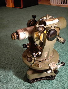
Figure 1: Theodolite
Application of Land Surveying
The earliest accounts of land surveying practices date back to 1400 B.C., when the Egyptians utilized rope to measure land dimensions in order to tax land plots. They did this by treating the cord with beeswax and resin. That way, the cord would remain stretched when tying it at significant distance points.
It was not until 120 B.C. that the Greeks invented the first surveying tool, the diopter. The diopter was essentially an astrological tool used to measure and map the positions of the stars. The diopter was later adapted to better suit land surveying in the 16th century and received the name of the theodolite. The theodolite (Figure 1) is a small telescope used in surveying to measure horizontal and vertical planes.
The applications for land surveying may also vary from private individuals wanting to build a fence around their property to large companies seeking to develop a high-rise condominium in the heart of a major city. Both parties would benefit from hiring a surveyor. The homeowner would need to map their land boundaries to avoid complications with neighbors, and the commercial real estate investor would need assistance to ensure the building stands straight.
Types of Land Surveying and Their Applications
Not all land surveying is alike; different surveying outcomes require other techniques to be performed. As far as the services Coffey Engineering & Surveying provides, the list is quite extensive.
Here is a brief sample of the most common types of land surveys conducted:
Boundary Survey
Land surveyors perform boundary staking by marking property corners and property lines with concrete monuments, irons pins and rebars, or wooden stacks. This type of surveying creates precise visible property boundaries for those who want to buy, divide, improve or build on land. After a boundary survey is complete, the surveyor will draw the specifications of the land. This drawing may include lot dimensions, added improvement features such as swimming pools and sheds, fences and easements.
Suppose a homeowner wants to fence their property, a boundary survey should be performed to accurately define land boundaries to avoid financial burden and project delay.
Subdivision Plats
Land surveyors perform subdivision plats by combining existing documents with an updated physical survey to create a subdivision plat. A subdivision plat is an outcome of dividing a large piece of land into smaller land fragments. This subdivision is usually performed to sell or divide parcels individually.
Suppose a family of six brothers has a 24,000-acre farm. If the brothers need to split an inheritance, a land surveyor could perform a subdivision plat to facilitate legal matters.
ALTA/NSPS Survey Plats
The American Land Title Association (ALTA) members need this survey to discover information not recorded in public records. An ALTA survey is the most detailed land survey available, with clients being able to choose from more than twenty items they need surveyed. It is a favorite amongst title insurance companies, as it encloses almost all required information before providing insurance coverage to property owners.
Suppose a real estate investor wants to purchase land; before closing the deal, it is wise to conduct an ALTA survey. That way, unrecorded risks may come to shore and help determine whether the investor should follow through with the acquisition.
For a more comprehensive list of Coffey’s land surveying services, visit our Surveying page.
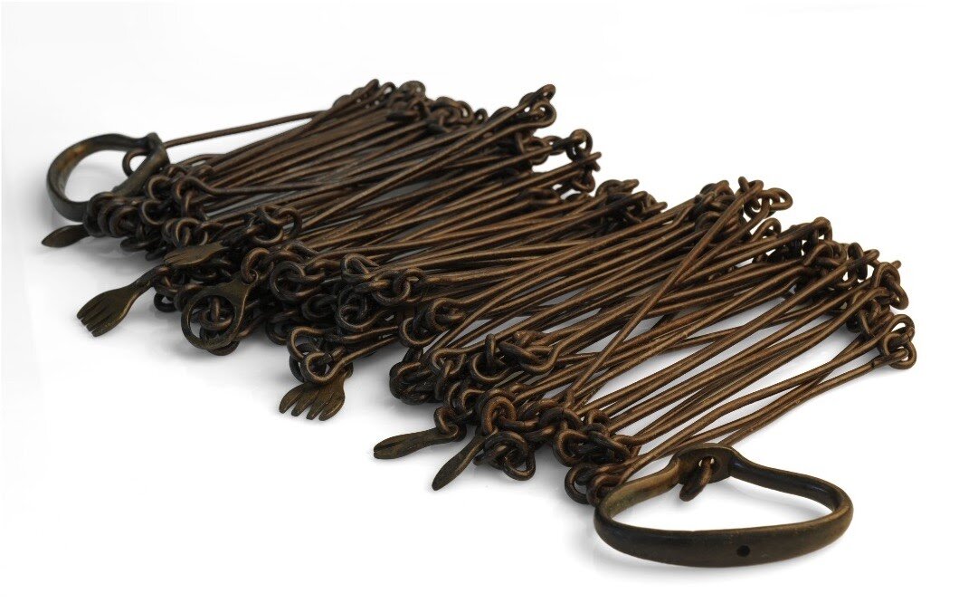
Figure 2: Compass and chain method
Surveying Technology
As there are many different types of surveys, there are also many tools used for surveying. We have come a long way from the compass and chain method (Figure 2)—an actual 66-foot steel chain that nearly every surveyor across the country used to measure horizontal distances. Surveyors then evolved into using transit and theodolites, which are two slightly different methods with a similar outcome: measurement of horizontal and vertical angles.
Today, industry practice uses a Global Positioning System (GPS), a complicated satellite that arrays to triangulate one’s position. This is the same technique employed by the military. Another method is the total station, which analyzes the slope between itself and a specific point, resulting in horizontal and vertical angles and distances.
Part of an industry strongly rooted in technology, Coffey maintains a dynamic approach to the tools it uses. We are in a constant evolution as we look for new ways to accomplish projects, staying connected with manufacturer representatives, their new products and more.
Below are some technologies Coffey surveyors use to measure land surfaces:
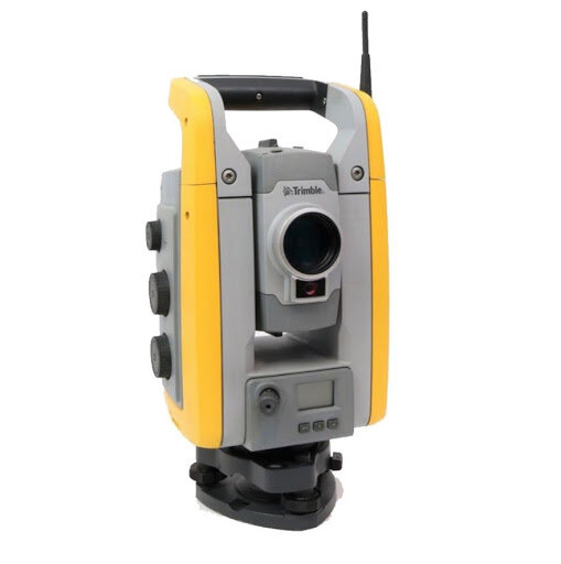
Figure 3: Total station
Total Station
A total station (Figure 3) is an electronic transit theodolite combined with electronic distance measurement, a tool that, besides measuring horizontal and vertical angles and distances, also performs triangulation calculations.
Coffey’s total stations can read angles and distances to 1/8th of an inch and a fraction of an angular second. At this precision, we must account for atmospheric considerations such as humidity that could refract the laser, wind conditions that could buffer against the instrument and swings in temperature that could shrink or swell the tripod legs. We consider all these influences when conducting a survey.
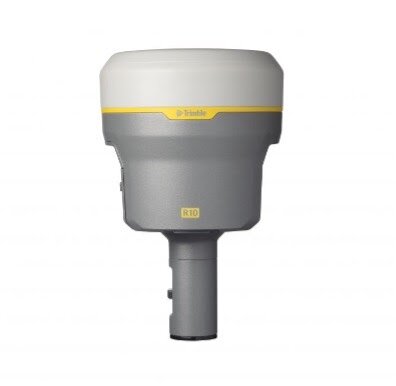
Figure 4: Global Positioning System
Global Positioning System (GPS)
Land surveying utilizes GPS technology (Figure 4) to measure angular reference without having intervisible points, ideally for when a large or remote region needs to be covered. GPS will typically provide accuracy of around 1/4th inch—a remarkable precision considering the machine is orbiting 12,550 miles above the planet.
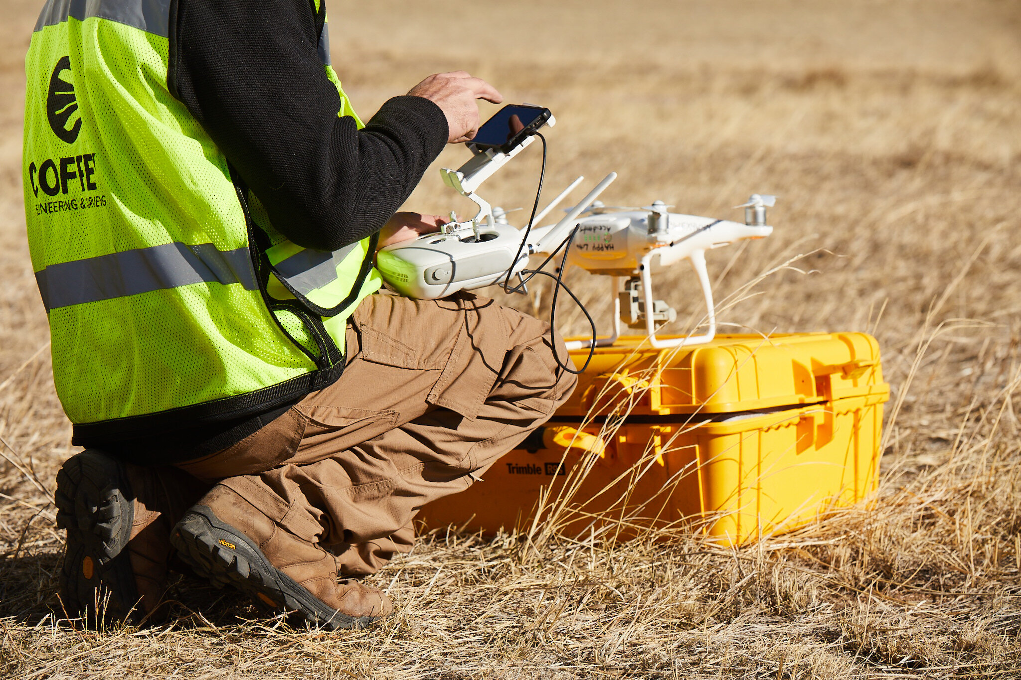
Figure 5: Coffey surveyor in the field with a drone
Unmanned Aircraft Vehicle (UAV/Drone)
A UAV, or drone (Figure 5), is an aircraft that combines GPS, robotics, automation, computing and sensitive photographic equipment in a single device operated from a ground-based controller.
Coffey has the licensure to use these drones and incorporates them into practice for precise surveying. The drones provide an advantage of time and effort in surveying, and also a unique benefit in areas with challenging terrain.
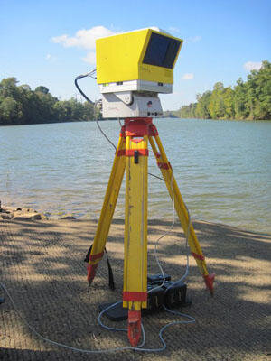
Figure 6: Light detection and Ranging (lidar). Source: www.usgs.gov
Light Detection and Ranging (Lidar)
Like UAVs, lidar (Figure 6) is another form of remote sensing that combines a laser, a scanner, and GPS into one device. A lidar system generates precise three-dimensional data from complicated regions, such as an underground mine, by pulsing light in the form of a laser into the Earth’s surface.
Why Survey with Coffey?
A 70-year old company, Coffey is comprised of engineers and surveyors with decades of experience and expertise. This helps us provide the best possible service to our clients. Each state contains a different set of regulations that surveyors may master only with on-field experience, as the regulatory bodies understand how crucial the hands-on experience is.
In regards to licensure, every surveyor takes an oath to protect public welfare above all means and work according to the highest professional conduct standards. It is considered best industry practice to provide service before profit, and Coffey understands this industry is significantly involved in the well-being and safety of the public.
Despite the age of our company, Coffey is constantly evolving and learning new technologies. Further, we cultivate a learning work environment to best serve society with the services they need while always honoring the pleaded oath.
Browse Articles


About Chase

Chase has a wide range of experience within land surveying, leading a variety of projects from ALTA survey plats for wind farms to boundary surveying for private homeowners.
He provides standardized, time-efficient and cost-effective surveying for every client in need.
Follow Coffey


Thank you for reading our article written by Coffey Engineering & Surveying Communications Specialist Julia Ribeiro, and Coffey Senior Project Manager Chase Cambridge, PLS. If you are interested in the application of land surveying for your project or have an inquiry about other civil engineering services, we invite you to contact us by email or phone.